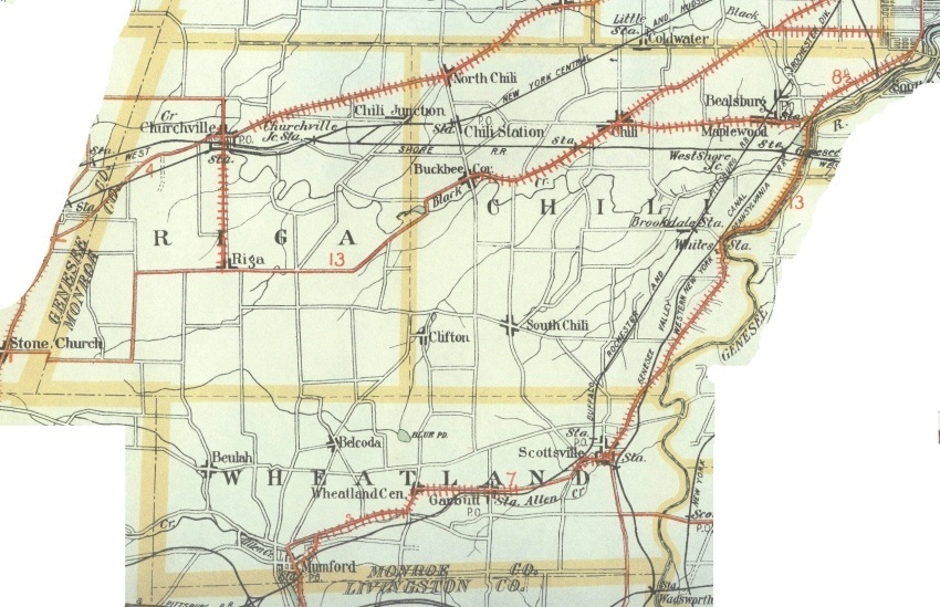
The next is a road map from 1908 which to me was fascinating. It's a highway map (there were so few in 1908) of Riga, Chili and Wheatland showing the importance of the NY Central railroad and the stations in Chili, Churchville, etc.
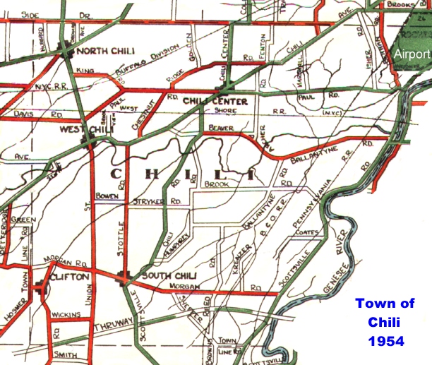
Then there is a highway map from 1954 which is apropos to this blog so I will include the picture here for flavor. It doesn't include all the new neighborhood streets like in Ranchmar or Chestnut Heights, but it gives a lay of the land in those days. It's kind of interesting to see what streets were considered most important and relatively important (Fenton Road, Marshall Drive, etc) enough to make the map. Of course, the new post-war neighborhoods were just being built when this map was drawn.
I recommend browsing about the site these links point to for other maps of the Monroe County area, especially the highway maps of Rochester itself in 1904 which is in two parts.
How little we knew of the history of our town and city when we were growing up there. Thank heavens for the breakthrough of cheap computer memory so now we can search through all these old documents.
No comments:
Post a Comment